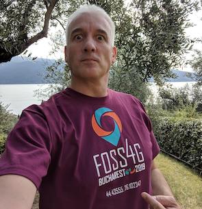
Andrea Antonello
HydroloGIS
The Road to Geospatial: How did it all start for you? What was your first geospatial undertaking?
“I have never been what you would call a brilliant student. I have been struggling through my Engineering course of study without having a real objective, which made everything just difficult. One year before graduation this “thing” called GRASS GIS came along and I started to finally get really interested in something. I found out that a tool that is potentially able to connect different environmental sciences is simply amazing. And its practical use-cases seemed limited only by imagination. There were even doctors using it to process tomographies! And since it was even an open source project, it was possible to exactly tailor it to my needs. I always had a huge need to be free to choose and to work at my own pace. I therefore chose to focus my master thesis on GIS development in order to force myself to learn. So I started to get in touch with the community and by the end of the thesis I had been able to develop my first GRASS commands. Those wavelet multilevelanalysis modules where my first achievement as a GIS developer and paved the way to what came after that. The first milestone was set by a proposal to work for a little while at the university department I graduated in. And from there on the free and open source rolling stone never stopped again.”
Conference experiences: Why should one come to FOSS4G and not go to another geo-event? What was your significant conference experience that helped you carve your career?
“When I finished my master thesis I had the luck that my university town – Trento – hosted one of the first FOSS4G conferences (even if at that time it was almost only GRASS focused). I had the possibility to present my wavelet modules and meet many incredible community members. That conference was the first one for me and lit a fire of interest inside that never justify me and that is still pushing me in a passionate way. At every single FOSS4G, being it Victoria, Cape Town, Sidney, Bonn or Guimaraes, I met people able to trigger new intriguing interests, to solve problems I wasn’t yet aware to have, to show me new technologies, to explain me different points of view. The gathering of that many brilliant open-minded people creates a pool of knowledge open to people eager to drink out of it. The multitude of people, ideas and involved companies help to gain perspective and even make professional choices. I’ve always considered these conferences small milestones along the path that made me who I am today. I now own a small consulting company that works on open source GIS and have the privilege to teach Advanced Geomatics at the University.”
What is your advice for students and young professionals at the beginning of their journey?
“In my Advanced Geomatics classes I usually start with a set of quotes. The once I prefer are the following:
– Coding is the language of the future, and every girl should learn it. As I’ve learned from watching girls grow and learn in our classrooms, coding is fun, collaborative and creative. – Reshma Saujani (Girls who code)
– Whether you want to uncover the secrets of the universe, or you just want to pursue a career in the 21st century, basic computer programming is an essential skill to learn. – Stephen Hawking
I strongly believe in the content of these quotes and from the moment I started teaching I focused on guiding students that never did any programming towards scripting, in my particular case geo-scripting.
My advice for young GIS professionals is the following: Learn a geo-scripting language, do it at the Foss4G workshops, at school if available or using online resources. It will greatly improve your way of thinking, it will foster your capacity to solve problems. And clearly, it will make a “cherry-on-the-pie” in your curriculum.”
